City · India · Uttar Pradesh · Agra District
Agra
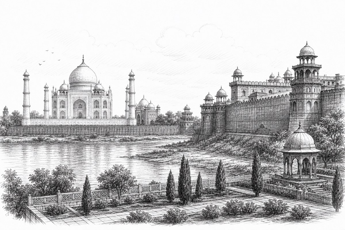
The Taj Mahal, Agra Fort, Fatehpur Sikri, and quieter views from the gardens across the Yamuna.
One canonical city journal
Everything for Agra, together
The Taj Mahal, Agra Fort, Fatehpur Sikri, and quieter views from the gardens across the Yamuna.
This page consolidates the city’s writing, photographs, mapped stops, practical detail, and locally matched saved places. Regional route pages remain useful for wider context, but this is the stable journal URL for Agra.
India trip planner · about 14 minutes
Plan a trip to Agra
Start with the essentials, choose a few meaningful sights and leave room for weather, traffic and unplanned discoveries. This guide combines the official English Wikivoyage dump with the journal’s verified map data.
Why visit
Agra is in Agra District, Uttar Pradesh. At a regional scale, Uttar Pradesh sits within the northern plains, where river systems, agricultural country, historic routes and fast-growing towns meet. This journal is a selective guide, not an instruction to visit every pin. Its strongest current themes are heritage. Choose places that explain the landscape or community instead of racing between unrelated coordinates.
A little history
Northern India contains layers of early settlement, pilgrimage, courtly capitals, market towns and imperial routes. Different places were shaped by regional kingdoms, the Delhi Sultanates, Mughal power, Sikh and other community histories, princely administrations and British colonial rule. Railways, canals, universities, industry and post-independence urban growth later changed how these centres connected. A smaller town may not contain every layer, so read its historic core, sacred places, civic buildings and transport routes as local evidence rather than forcing a single north-Indian story onto it.
In and around Agra, begin that larger story with Agra Fort, Amar Singh Gate and Chauburji. Read a monument or sacred place together with its street, water source, settlement, farmland or old route. Dates and dynasties help, but living use matters too: ask permission where appropriate and distinguish a protected structure from a place that still serves everyday civic or religious life.
Best time and trip length
October–March usually offers a practical starting window for this part of India, but altitude, coast, festivals and unusual weather can shift the best dates. Summer heat and winter fog can both disrupt a day, while the monsoon affects road and river conditions. Check the short-range forecast, daylight and district advisories shortly before travelling instead of treating a seasonal rule as a guarantee.
Plan two unhurried days. Start early for open landscapes and major sacred or heritage stops, leave the hottest or wettest part of the day for a meal, museum or rest, and keep one part of the schedule empty. That margin absorbs traffic, security checks, a delayed connection or a place that deserves longer than its map marker suggested.
Getting there
The relevant Wikivoyage source material discusses flights, trains, intercity buses, ferries or boats and taxis or auto-rickshaws. Treat these as transport options, not as a current timetable. For a smaller locality, identify the district transport hub first, then verify the final connection with an official operator, station enquiry or accommodation host.
Search by the exact locality and district because India contains repeated and similarly spelled place names. Reserve constrained trains, flights or intercity buses ahead around festivals and weekends. For a late arrival, mountain road or group with luggage, a pre-arranged taxi may be sensible; agree on the fare or meter expectation before departure.
Getting around
Build the day in geographic clusters. Open the journal map, select only the categories needed, and group places on the same side of a river, ridge, railway or town centre. Short distances can take time on narrow roads and busy approaches. Walk in compact heritage or market areas; elsewhere combine local buses, metro or suburban rail where available, auto-rickshaws and taxis according to terrain.
Keep the place’s actual Google Maps listing open for the final approach, but do not let navigation override a gate sign, protected-area instruction or local advice. Confirm the return journey before entering a remote trail or staying for sunset. At night, use established pickup points and share vehicle or route details when travelling alone.
Top sights
These highlights come from the journal’s own canonical place data rather than a copied business directory. They favour heritage, sacred, cultural and natural sights. Use the map for locations and category filters; use the notes below to approach each stop thoughtfully.
-
Agra Fort
UNESCO World Heritage Site Near the gardens of the Taj Mahal stands the important 16th-century Mughal monument known as the Red Fort of Agra. This powerful fortress of red sandstone encompasses, within its 2.5-km-long enclosure walls, the imperial city of the Mughal rulers. It comprises many fairy-tale palaces, such as the Jahangir Palace and the Khas Mahal, built by Shah Jahan; audience halls, such as the Diwan-i-Khas; and two very beautiful mosques.
-
Shish Mahal
Palace A verified palace attraction in this city; check current access and visitor details before going.
-
Taj Mahal
Monument A verified monument attraction in this city; check current access and visitor details before going.
-
Jama Masjid
Place of worship A verified place of worship attraction in this city; check current access and visitor details before going.
-
Moti Masjid
sacred A verified sacred attraction in this city; check current access and visitor details before going.
-
Chini Ka Rauza
place A verified place attraction in this city; check current access and visitor details before going.
-
Mehtab Bagh
Garden A verified garden attraction in this city; check current access and visitor details before going.
-
Chauburji
Heritage site A verified heritage site attraction in this city; check current access and visitor details before going.
-
Akbari Mahal
Palace A verified palace attraction in this city; check current access and visitor details before going.
-
Jahangir mahal and Shahjahan Mahal
Palace A verified palace attraction in this city; check current access and visitor details before going.
Experiences worth making time for
The source coverage and local map point towards heritage walks, living sacred places, boating, wildlife watching and walking or trekking. Choose one experience that requires time—a walk, performance, nature visit, boat journey or extended heritage circuit—and let the other stops support it. Use authorised access in forests, reserves, caves, reservoirs and border areas, and respect seasonal closures.
Photography should never displace the people or place. Ask before photographing worship, ceremonies, performers or residents; observe drone restrictions; and avoid geotagging fragile locations where publicity could cause damage. A locally operated guide can add context, but verify credentials and agree on scope and price first.
A simple itinerary
Morning: begin with the most important heritage, sacred or natural place near opening time, then add one nearby secondary stop and an early local lunch. Afternoon: choose a shaded museum, garden, market street or waterside route, and return to an established public area before dark unless a later activity is organised.
If you have a second day: move outward into the district landscape—coast, forest, plateau, river valley, craft village, pilgrimage centre or neighbouring historic town according to the setting. Do not combine distant points simply because a map can draw a route. A slower day reduces repeated driving and leaves space for weather, conversations and closures.
Food and drink
Northern food traditions commonly use wheat and rice, pulses, dairy, seasonal vegetables, breads and richly varied snacks. Recipes, meat traditions and spice levels change greatly between states, cities and communities.
Choose busy local establishments with visible turnover or well-known institutions supported by reliable sources. Ask about spice and ingredients when needed, confirm whether prices include tax and use sealed or safely filtered drinking water. Routine eateries stay off the city map unless they are especially notable.
Money and shopping
India uses the Indian rupee, written as INR or ₹. Carry some cash in smaller notes for local transport, markets, tips and places where card terminals or mobile data fail. Cards and QR payments are widespread in many towns, but overseas visitors should confirm that a specific card or app works before relying on it. Use bank-affiliated ATMs and shield the keypad.
Buy fewer items with a clear local connection—textiles, craft, books, food or agricultural products from established makers and sellers. Check restrictions for wildlife products, plants, antiques and religious objects. Bargaining may suit some informal markets but not fixed-price shops; remain courteous and walk away rather than turning it into a contest.
Where to stay
Choose the location before the room category. A central stay makes an early walk, station transfer or evening meal easier; a rural, coastal, forest-edge or mountain stay trades convenience for landscape. Check recent reviews for cleanliness, noise, final-road access, hot water or cooling and mobile signal.
Confirm the full price, taxes, cancellation terms and identification requirements directly with the property. A registered homestay can add local context when expectations are clear. Never assume that a scenic room grants access to neighbouring fields, rooftops, forests or sacred land.
Safety, respect, language and internet
Travel safely and respectfully
Use ordinary city precautions: protect valuables in crowded transport, choose established operators at night and be cautious around isolated water, cliffs, wildlife, heat and poor footing. Weather can produce floods, rough seas, landslides, dust or sudden closures. Follow official instructions even when another visitor says a route was recently open.
Dress and behave appropriately at places of worship; footwear, photography and entry rules differ by site. Ask before entering ceremonies or private compounds. Carry prescribed medicine, sun and rain protection, water and accommodation details. For an emergency in India, use the national emergency number 112.
Language and staying connected
Hindi and Urdu are useful languages. Hindi and English can help in many transport and tourism settings but are not substitutes for local language and courtesy. Show the written destination and district when pronunciation or spelling varies.
Mobile coverage can weaken in mountains, forests, islands and border districts. Download the map before leaving reliable service. Use official tourism, transport, protected-area and district channels for time-sensitive information; a local confirmation and one backup plan are more reliable than an old opening time from any guide.
Where to go next
Continue within Agra District or Uttar Pradesh before making a long transfer. This keeps the geographical story coherent and reduces time lost to transit. The links below combine nearby Traveling Gander journals with destinations mentioned by the validated city source where available.
Wikivoyage sources, contributors and CC BY-SA 4.0 licence
The August 2026 English Wikivoyage dump contains a geographically validated guide for Agra. This planner reorganises durable orientation from that guide and combines it with Agra’s verified place bundle. Timetables, prices and individual business details are not treated as permanent facts.
This adapted planning guide uses the 2026-08-01 English Wikivoyage dump. Source revisions:
- Agra revision 5320462 · contributors and history
- Uttar Pradesh revision 5308426 · contributors and history
- India revision 5322346 · contributors and history
The adapted guide text inside this section is available under the Creative Commons Attribution-ShareAlike 4.0 licence. It has been condensed, reorganised and combined with Traveling Gander’s independent map data. No Wikivoyage images were reused. See Wikivoyage’s reuse guidance.
Consolidated journal
Descriptions, photographs, and details
The entry below preserves the useful material that previously lived on an independent journal page.
Opening frame
The monument and the city around it
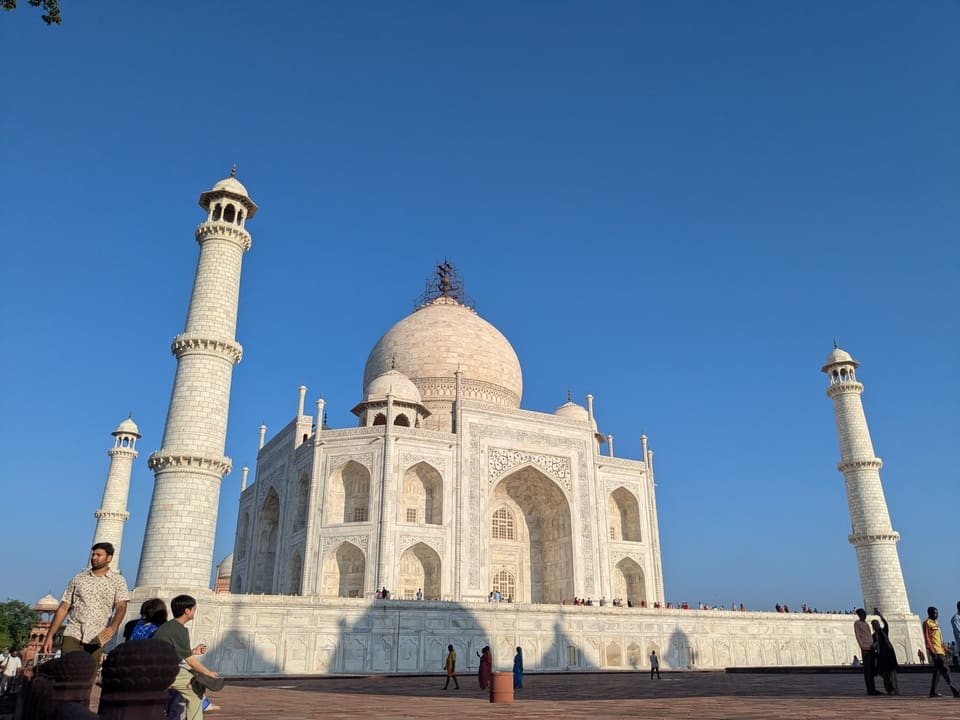
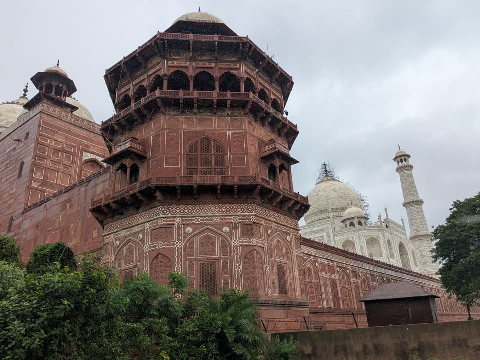
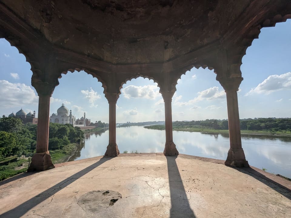
Agra is easy to reduce to one perfect marble profile. The photographs from this visit resist that shortcut. They begin with the Taj Mahal’s precise symmetry, then place it in conversation with red sandstone ramparts, open courtyards, dry ridges, trees, and the slow width of the Yamuna landscape.
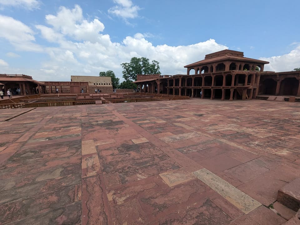
That change in scale is the story of the trip. Close up, the eye follows carved surfaces and repeating arches. From Agra Fort and the nature walk, the same building becomes a distant point of orientation. At Fatehpur Sikri, the visual language expands again into a whole planned imperial complex.
Three-day route
Build the visit in layers
Taj Mahal
Start early, leave time to walk the full garden axis, and look back as often as forward.
Agra Fort
Move through red sandstone courts and seek the framed views towards the Taj across the river.
Fatehpur Sikri
Treat the former imperial capital as a half-day excursion rather than an extra stop.
River landscape
Finish with a quieter garden or nature-walk perspective where the skyline can breathe.
Photo essay
Red sandstone, marble, and distance
The sequence below follows how the trip changed its point of view: from a monumental complex to a distant silhouette and then to an imperial city on a ridge outside Agra.
Before you go
Simple choices make a better visit
Begin early
Morning light is gentler, temperatures are usually kinder, and the main garden is easier to read.
Keep one half-day open
Fatehpur Sikri sits outside central Agra. Giving it its own block avoids rushing both sites.
Travel light
Security rules can limit what enters protected monuments. Check current official guidance.
Look beyond the gate
The best understanding comes from pairing close architectural detail with views across the landscape.
Context
Official reading
Historical context was checked against UNESCO’s entries for the Taj Mahal, Agra Fort, and Fatehpur Sikri.
Broader route context remains in the source travel guide.
Personal shortlist
Want to Go places around Agra
These pins come from the personal Google Maps Want to Go collection and fall inside this city’s mapped boundary or local radius. Every matching pin is available on the searchable map above.
Journal notes
Use this as a living travel record
Verify current access
Opening hours, permits, transport, weather, and local rules can change after a journal entry is written.
Read the map selectively
The saved list is a set of possibilities, not a checklist. Filter it and build a route around one compact area at a time.
Distinguish visits from ideas
Green journal stops are documented or photographed; red Want to Go pins remain future possibilities.
Add the next chapter here
Future descriptions and photographs now have one stable city page instead of being split among collection pages.